This trip covers 50 miles of the northern portion of the Wind River range over four days. On Tuesday afternoon we drive to the Green River trail head north of Pinedale. It should take us six hours to cover the 300 miles from. If we leave at 4 PM that would put us in at 10 PM.
Returning home on Saturday we should arrive late in the evening.
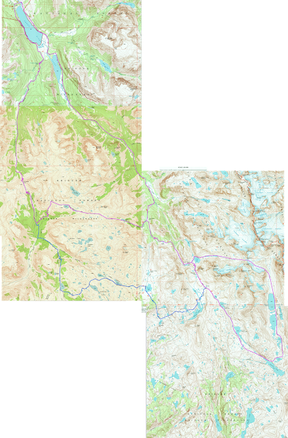
The route is basically a big figure eight. It can be turned into a loop trip by taking the alternate route shown in blue. The alternate route doesn't seem as scenic and it is a bit longer, but has less elevation change.
Day one - 15 miles - 2000 feet gain. Two half a mile steps of 1000 feet. Camp two miles before Peak Lake
Day two - 10 miles - 2000 feet gain, 1500 feet loss. Camp end of Titcomb basin/Island Lake
Day three - 13 miles - 1600 feet gain, 1600 feet loss. Camp clark basin
Day four - 12 miles - 1000 feet gain, 2500 feet loss. Drive home

In this Google Earth overlay you can see the general topology of the hike. You start out on the top right and move along the Green River to the Southeast. You ascend up into the high country, past Peak Lake, and go over Knapsack Col into Titcomb Basin. The return trip takes you back to Peak Lake and then up Clark Creek and eventually to Porcupine Pass back down to Green Lake.
Related Trip Reports
This trip report covers the top half of the figure eight over four days.
This trip report comes it from New Fork (closer to Pinedale) and loops the Clark Lake/Alternate route portion of our hike.


No comments:
Post a Comment